

Ship Radar - Ship Positions

Descrizione di Ship Radar - Ship Positions
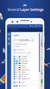
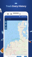
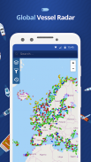
🌟 All vessels live on a map 🌟
➡️ You have the option to choose between 4 map types: Standard map, Simple map, Satellite map or OpenStreetMap
➡️ Every vessel type is marked in a specific color
➡️ You can explore plenty of different vessel types: Fish carriers, Crude Oil Tankers, Fishing Vessels, Other Tugs / Special Crafts, Bulk Carriers, Fire Fighting Vessels, Service Vessels, Passenger Ships, Training Ships, Yachts and much, much more
➡️ Besides vessels, the map contains ports and other locations
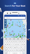
🌟 Search option 🌟
➡️You also have the option to search for specific vessels by IMO number or MMSI, ports, seas or other locations.
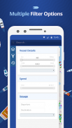
🌟 Filter option 🌟
➡️Sort out specific vessel types, so that you only get to see what you want to see.
🌟 Vessel information 🌟
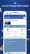
➡️ Get various pieces of vessel information by tapping on a vessel symbol such as speed, course and current status. You also get to see a picture of each vessel.
How does it work?
---------------------------------
We are using AIS data to provide you most accurate information. If you want to track vessels you just have to tap on "Start ship radar"
🌟 Tutte le navi vivono su una mappa 🌟
➡️ Hai la possibilità di scegliere tra 4 tipi di mappe: mappa standard, semplice mappa, mappa satellitare o di OpenStreetMap
➡️ Ogni tipo di imbarcazione è segnato in un colore specifico
➡️ È possibile esplorare un sacco di diversi tipi di navi: vettori di pesce, greggio petroliere, navi da pesca, Altro Rimorchiatori / mestieri speciali, navi portarinfuse, Fire Fighting Vessels, imbarcazioni di servizio, navi passeggeri, navi scuola, Yacht e molto, molto di più
➡️ Oltre ai vasi, la mappa contiene porte ed altre destinazioni
🌟 Ricerca opzione 🌟
➡️You hanno anche la possibilità per la ricerca di una determinata nave per numero IMO o MMSI, porti, mari o in altri luoghi.
🌟 opzione Filtro 🌟
➡️Sort out specifici tipi di navi, in modo che si ottiene solo per vedere che cosa si vuole vedere.
🌟 informazioni Vessel 🌟
➡️ Ottenere varie informazioni nave toccando un simbolo nave, come velocità, direzione e lo stato attuale. Potete anche arrivare a vedere una foto di ogni nave.
Come funziona?
---------------------------------
Stiamo utilizzando i dati AIS per fornire informazioni più accurate. Se si desidera tenere traccia vasi basta toccare "nave radar Start"


